Kathmandu, The City of Temples
Kathmandu is the arrival point for most of the visitors in Nepal. This small mountain sheltered valley is the historic center and the capital of Nepal. This is the place where kingdoms rose and fell, palaces and temples are built and rebuilt, art and cultures are refined and protected. Kathmandu city is the largest in Nepal and is surrounded by green hills all over. Scattered around the valley are hundreds of temples and shrines, traditional villages and agriculture scenes of timeless beauty. You can see all these places by taxi, cycle, bus and by foot.
Temples and Palaces in Kathmandu
Swoyambhu Stupa

Swoyambhu, the Buddhist temple is situated on the top of a hill west of the city, is one of the popular and instantly recognizable symbols of Nepal. The temple is also known as the monkey temple after the large tribe of monkeys which guards the hill. Although you can get to the temple by vehicle, and save yourself is by far the best way of approaching Swoyambhu. This huge stupa is surrounded by other famous temples and gompas. The great thunderbolt which is known as vajra is on the edge of the stupa was built during the Malla kings period. On the top of the stupa is a gold-colored square block from which the watchful eyes of the Buddha gaze out across the valley in each direction. The question mark-like nose is actually the Nepali number ek or one is a symbol of unity.
Pashupati Nath

Pashupati Temple is is one of the most important and world renowned Hindu temple standing on the banks of the Bagamati River , between the airport and Boudha. This Shiva temple on the subcontinent draws numerous devotees, sadhus and holy men from all around the world. Lord Shiva is known as the destroyer and creator of the Hindu religion and appears in many forms. Although Shiva is often bloodthirsty god, no animal sacrifices are made here. Outside the temple you will see numerous people selling flowers, incense and other offering materials. In-front of the temple there is a bull known as Nandi facing towards the temple. Only Hindus are allowed to enter the temple and you are not allowed to take photographs of the Lord shiva inside the temple. Bagamati River Bank on the side of Pashupati, is also a popular place for cremation. Normally you see visitors taking videos and photographs around this place. Just beside this temple lies Guheyeshwari temple where you will see all the Hindus removing their shoes before entering.
Bouddha
Just north of the airport and an interesting walk from Pashupati, is the huge stupa of Bouddha and is one of the largest stupa in the world. This place is mostly surrounded by Tibetan Buddhists. Prayer services are held in the surrounding gompas and as the sun goes down the community turns out to walk around the stupa. You should always circle around the stupa in a clockwise direction. While entering the surrounding gompas, do not forget to remove your shoes and get permission before taking photos. Make sure that you do not step over the monks cushions. Enter quietly and stand by the main entrance during the ceremonies. These gompas are decorated with impressive mural paintings and thankas. The wheel of life is represented in the porch of every gompa. Listed here are the name of the gompas surrounding Boudha.Sakyapa Gompa, Chinya-Lama Gompa ,Nyingmapa Gompa, Kargyupa Gompa, Gelugpa Gompa.
(In Durbar Square)
Kasthamandap -Temple of wood which gave Kathmandu its name.In Sanskrit language, "Kastha" means "Wood"and "Mandapa" means "House". Thus, due to this very monument was the name Kathmandu derived. It is said that this wooden house was made out of the timber of a single tree. in 1596 AD.
Ashok Binayak -One of the four most important Ganesh Shrines. It is said that before this temple was made, in this very place was an Ashoka tree in which the God resided. Once a Malla king dreamt of the God who asked him to build a temple for him. The king ordered to build a temple for this God. The Ashoka tree was cut and the temple was built. When the workers were ready to put the pinnacle, the King had a second dream. The God asked him to put the shrine pinnacle less so that he could travel through the opening in the roof to heaven. Hence, the pinnacle was not put on the temple. In shape and size, the temple may look insignificant but it is one of the most frequented temples in the city. During the coronation, even the king has to come to the temple for Darshan (pay homage) and blessings.
Shiva Temple -Near the kasthamandap
Maju Deval -Temple known as shiva lingam
Narayan Temple -Identified as temple of Vishnu
Shiva-Parvati Temple -Images Shiva & Parvati look out from the window
Kumari Bahal -House of the Living Goddess
Gaddi Baithak -European style building built during the Rana period
Bhagwati Temple -Triple roofed temple next to the Gaddi Baithak
Great Bell -To drive off evil spirits
Stone Vishnu Temple -Next to the bell is a small stone statue
Saraswati Temple -Temple of the Goddess of knowledge
Krishna Temple -Lord Krishna's temple and two goddesses
King Pratap Mallas Column -Huge platform with stone pillars
Sweta Bhairab -Can be seen only during the Indra Jatra
Jagannath Temple -Built during 1563
Kal Bhairab -image of Black Bhairab with six arms
Indrapur Temple -Temple of great antiquity
Vishnu Temple -Tripled roofed temple stands on a four-level base
Kakeshwar Temple -Temple built in 1681 with Indian shikhara style
Stone Inscription -Stone inscription written in 15 different languages
Kotilingeshwar Temple -A square structure topped by a dome
Mahavishnu Temple -Golden spire on the roof, topped by a golden umbrella
Mahendreswar Temple -Temple restored in 1963 and is dedicated to Shiva
Taleju Temple -The squares most magnificent temple
Hanumandhoka
Hanumans statue marks the entrance or dhoka to Kathmandu's old Royal Palace and has given the palace its name. The place was originally founded during Licchavi period , but as it stands today of it was constructed by King Pratap Malla and his Queen.
Nasal Chowk-Nasal Chowk means dancing one and the courtyard takes its name from a small figure of dancing Shiva. Inside the nasal chowk, there is a large statue of Narshigha, The Kabindrapur Temple, Pancha Mukhi Hanuman Temple, Basantapur Tower, Mul Chowk, Degutaleju Temple, Mohan Chowk and Rana museum.
Nara Devi Temple -Temple which gave the street its name
Ganesh Shrine -Brass Ganesh Shrine in Indrachowk
Shiva Temple -Smaller version of Patan Krishna Mandir
Sweta Macchendra Temple -Temple attracts both Hindus and Buddhists
Lunchun Lunbun Ajima -Tantric Temple
Krishna Temple -Temple jammed between buildings in Ason Tole
Annapurna Temple -Dedicated to the goddess of abundance
Ugratara Temple -A prayer at the shrine said to work wonders for the eyes
Ikha Narayan Temple -Temple with four armed Vishnu figure
Kathesimbhu Stupa -south of Thahiti Tole
Jaisi Deval Temple -Shiva Temple, as shown by the bull on the first few steps
Ram Chandra Mandir -This temple is notable for the tiny erotic scenes on its roof
Adko Narayan Temple -One of the four most popular Vishnu Temple
Kalmochan Temple -On the side of Bagmati River, known as kalmochan Temple
Tripureshwar Mahadev -Along the footpath of Tripureshwar
Tindeval Temple -It is recognized by its three shikaras
Pachali Bhairab -The image of Pachali surrounded by tridents
Nava Durga Temple -A small two storey pagoda
Mahankala Temple -The Temple of Great Death
Bhaktapur 
Bhaktapur,also known as Bhadgaon or the city of Devotees,is the third major town in the Kathmandu Valley. Bhaktapur was the capital of the whole valley during the 14th to 16th century. Much of the town's great architecture dates from the end of 17th century. This town is also well known as Newari Architecture town. Bhaktapur rises upon the northern bank of Hanumante River. All foreigners visiting Bhaktapur Durbar Square are charged a fee.
Bhaktapur is also famous for their home made curd which is known in Nepal as Khopa Dhau. Bhaktapur is also the pottery center of the valley and a visit to Potters' square is a must. You will get to see lots of different types of handmade souvenirs ( wood-carvings, puppets, thangkas, caps etc.) inside the Square.
Golden Gate & 55 Window Palace
This famous 55 Window palace was built during the period of King Bhupatindra Malla in 1754. The entrance to this Palace is well known as Golden Gate or Sunko Dhoka in Nepali, and is the most important piece of art in the whole valley. A Garuda tops the gate and is shown disposing of a number of serpents. The four headed and 16 armed figure of the goddess Taleju Bhawani is below the Garuda.
Hill Stations
There are various places around the edge of the Kathmandu Valley which offer great views. These places are not so far away from the valley and easily accessible.
Nagarkot
Nagarkot is generally hailed to be the best for the mountain watchers. People normally spend the night in one of the lodges to see the sun set and sun rise. Nagarkot extends the views all the way from Dhaulagiri in the west to Kanchanjunga in the east. There are number of walks from Nagarkot, down to cheese factory, Sundarijal, Changu-Narayan and Bhaktapur. It is about an hours drive from Kathmandu.
Dhulikhel
On the skirts the southern side of Bhaktapur , down to Banepa , towards to Tibetan border is a hill station called Dhulikhel. It is easier than the steep and winding road to Nagarkot, is also famous for the short treks. Its population is Newar, although there are people of many other groups in the surrounding villages. This place was gathering point of hippies who even planned to build their own temple here. This place is also surrounded by Harisiddhi temple, Vishnu Temple, Krishna Temple and Bhagwati Temple, Shiva Temple and Famous Kali temple. People often spend the night in one of the lodges here to sun set and sun rise. It is about an hours drive from Kathmandu
Phulchwoki
This 2,762 m. hilltop is the highest point around the valley and is also known as home to one of the last surviving cloud forest in central Nepal. This place is just 45 minutes drive from the valley and the only place, where snow falls during the winter. Above all, there lies a shrine of Phulchwoki Mai. Generally visitors travel by cycle to Godavari and walk all the way to Phulchwoki as it is known for the short walk destination.
Lalitpur, The City of Beauty
Patan is separated form Kathmandu by the Bagmati River and is the second largest town in the valley. It is also known as Lalitpur, which means city of beauty. Patan has a long Buddhist history and have stupas at four corners. Like Kathmandu Durbar Square, Patan Durbar Square is also packed with temples. Most of these temples are built during the Malla kings period.
Durbar Square
As in Kathmandu, Patan also has an old royal palace built during the Malla kings period. Most of the temples here are built in Newari architecture. The rectangular square has an axis from north, south, east and west to the Royal Palace. Malla kings who used to rule over Patan in the ancient times used to love art and architecture. To fulfill their wishes, many buildings having excellent arts such as wood carving, stone carving etc. were made. These buildings, which were created by skilled Nepali architects have stood firmly for centuries defying all the barriers of nature.
Temples and Palaces in Patan
Bhimsen Temple -Temple dedicated to the god of trade and business
Manga Hiti -Wonderfully carved stone crocodile headed waterspouts
Vishwanath Temple -Temple built in 1627 has two large stone elephant guarding
Krishna Mandir -Well renowned stone temple of Lord Krishna
Jagannarayan Temple -Temple is dedicated to one of Vishnus incarnations
Hari Shankar Temple -The half Vishnu half Shiva deity
Bhai Dega Temple -Temple dedicated to Shiva
Royal Palace
The Royal Palace is located in the heart of Patan, Mangal Bazaar. Parts of the Royal Palace was built in the 14th Century and main construction was done during 17th & 18th Century by Malla kings.
Mul Chwok & Taleju Temple
This is one of the largest courtyard among the three main chowks. Bidya Temple stands at the centre of the courtyard and three Taleju temples stand around the courtyard.
Sundari Chowk & Tusha Hiti
South of the Mul Chowk is the Sundari Chowk with its sunken tank known as Tusha Hiti Mul Chwok & Taleju Temple. This is one of the largest courtyard among the three main chowks. Bidya Temple stands at the centre of the courtyard and three Taleju temples stand around the courtyard.
Mani Keshar Chowk
This is the northern courtyard to be entered through golden gate. The golden gate is gilded with Shiva, Parvati, Ganesh and Kumar. This is the newest part of the palace. Above the golden door is a golden window from there king would make public appearances.
Golden Temple
This temple is known as Kwa Bahal among Newari people and Hiranya Verna Mahavihar among the others. This unique Buddhist monastery is well known as Golden Temple. This monastery was found in the 12th century and recorded its existence in 1409. The simple entrance gives no hint of the magnificent structure in the courtyard within.
Gorkha, Where Monarchy Began
Gorkha lies almost midway between Kathmandu and Pokhara. After travelling from Kathmandu towards Pokhara for 118 kilometers, the diversion to Gorkha is on the intersection at Abu Khaireni, and from there it is a short 18 kilometers drive northward to the birthplace of King Prithvi Narayan Shah, the first ruler of the Shah Dev Dynasty.
Situated on a hill overlooking the snowy peaks of the Himalaya is the beautiful Gorkha Durbar, a fort, palace and temple complex. It was built during the reign of King Ram Shah (1606-1636). It was from this very palace that King Prithivi Narayan Shah began his campaign to unify the kingdom of Nepal. The temples of Gorhakhnath and Kali within the outstanding examples of Nepali architecture. Treks to Manaslu and Annapurna Circuit Treks begin from here.
Lumbini, Birthplace of Buddha
Lumbini, the place where Lord Buddha was born, is a popular destination for Buddhist pilgrims as well as visitors from many different parts of the world, and also is regarded as a symbol of peace and understanding in the world community. Lumbini, like the Buddha, stands peacefully and calm, away from the crowds of the cities, on the southern plains of the country, surrounded by forests. Lord Buddha is believed to have been born in Lumbini as Prince Sidhartha, when his mother Queen Mayadevi of Kapilbastu stopped to rest on her way to her parent's palace in a neighboring country some 2,600 years ago. People here also believe that she chose the place because of its peaceful setting. Although there are no cities or heavy population nearby, there are plans to develop the area, with gardens, trees, canal, accommodation facilities and even a library. Adequate lodging is available to the visitor and pilgrims, including a luxury hotel made by the Japanese.
Getting there,Visitors can take a flight to Bhairahawa and take a bus or rent a jeep or a three-wheeler to the area. In addition, there are regular bus services linking Bhairawa and Kathmandu.
Ashoka Pillar
Believed to be put up by Emperor Ashoka in 250 BC, the pillar is six meters high of which half lies under ground. Ashoka was a great believer of Lord Buddha and exempted the area from all taxes.
Maya Devi Temple
Only recently archeologists have found a commemorative stone atop a platform of seven layers of bricks five meters below where the temple once stood, that was demolished to make way for the dig in 1993. Buddhist scripts say Ashoka placed a stone on top of the bricks on the birth place of Lord Buddha.
Mustang, Barren Beauty
In March 1992, the 'forbidden' kingdom of Mustang was opened to the outside world. Now, for the first time in recent history, foreign travelers are able to visit Lo Manthang, the seat of an ancient kingdom dating back to the 15th century. The Kingdom of Lo is situated along the north central border of Nepal north of the main range of the Himalayan in the upper reaches of Mustang District . Lo and the area directly to its south, called Baragaon, which both fall within Upper Mustang,can be claimed as one of the most outstanding areas of the Himalaya.
The people of Upper Mustang are called Bhotias, and those from Lo are called Lobas. They speak various dialects of Tibetan. Historically, their art and culture flourished due to contact with traders, monks and religious masters passing between Tibet and India, or between Ladakh and Bhutan.
The climate and geography of Upper Mustang are nearly identical to those of Western Tibet and as such, they are dramatically different from the temperate and tropical areas of the south side of the Himalayas. The dry, wind swept ecology of this Trans-Himalayan region is extremely fragile, Fuel wood is virtually non-existent, water is scarce, the agricultural land yields insufficient food grains, and the marginal, and grasslands support only limited numbers of livestock and wildlife . With the influx of tourists, the already pressured desert environment risks further degradation.
In addition, although the culture has flourished in contact with other religious and cultural center of the Himalayas, its sudden exposure to other worlds beyond its high plateau may create a negative impact on the society.
In order to keep the destructive environmental and cultural impact of tourism in Upper Mustang to an absolute minimum, the Ministry of Tourism has decided to develop the area as a model eco-tourism area.
The Ministry of Tourism, has proposed that part of the revenue generated from trekking royalties to Upper Mustang ($ 700 for 10 days and $ 70 for each additional day) be earmarked for use in UMCDP to sponsor environmental and cultural preservation efforts and community development works. An Upper Mustang Development Fund is also being established with the financial support of the Ministry of Tourism and the American Himalayan Foundation.
Muktinath, which lies in Mustang, is a pilgrimage center for Buddhist and Hindus. The shrines include a Buddhist Gompa and the Vishnu temple Jwala Mai. An old temple nearby shelter spring and natural gas jets, which provide Muktinath with the famous eternal flame. Jomsom is the only place along the Annapurna circuit, which is connected by air with Pokhara and Kathmandu. It is also the district headquarters of Mustang, which includes part of the legendary Mustang and the Muktinath Region. Trekking to Muktinath begins from Jomsom. The trailsare easy to go to along the Kaligandaki River and reach to village of Kagbeni, a Tibetan influenced settlement close to Lo-Manthang, the capital of what used to be the old principality of Mustang. From Kagbeni village the trail climbs steeply to rejoin the regular trial before Khingar is reached. A further climb brings you to Jharkot then Ranipauwa, the accommodation area of Muktinath (3,710m.), where you can see most impressive views of Mt. Dhaulagiri, Tukche peak, Thapa peak, Dhampus Peak, Nilgiri north and Tilicho Peak.
Pokhara, City of Adventures
Pokhara is a remarkable place of natural beauty. Situated at an altitude of 827m from the sea level and 200km west of Kathmandu valley, the city is known as a center of adventure. The enchanting city with a population of around 95,000 has several beautiful lakes and offers stunning panaromic views of Himalayan peaks. The serenity of lakes and the magnificence of the Himalayas rising behind them create an ambience of peace and magic. So today the city has not only become the starting point for most popular trekking and rafting destinations but also a place to relax and enjoy the beauty of nature.
Pokhara is part of a once vibrant trade route extending between India and Tibet. To this day, mule trains can be seen camped on the outskirts of the town, bringing goods to trade from remote regions of the Himalaya. This is the land of Magars and Gurungs, hardworking farmers and valorous warriors who have earned worldwide fame as Gurkha soldiers. The Thakalis, another important ethnic group here, are known for their entrepreneurship. The climate of Pokhara is slightly warmer than Kathmandu with daytime temperature hovering around 15 degrees Celsius in winter and 35 degrees in summer. The monsoon season which lasts from mid-June to mid-September is very wet; in fact Pokhara records the highest rainfall in the country. Best time to visit is between October and April. The activities of foreign visitors to Pokhara focus around two districts known as Damside and Lakeside (or Pardi and Baidam, in Nepali, respectively). These two areas, with their strips of hotels and restaurants, are a few kilometers south-west of the main Pokhara bazaar
Phewa Tal (Lake)
Phewa lake, the second largest lake in the kingdom, roughly measuring 1.5 km by 4 km, is the center of all attractions in Pokhara. The enchanting lake is an idyllic playground. Brightly painted wooden boats and sailboats can be rented on reasonable cost around lakeside. The lake is neither deep (roughly 47 meters at most) nor particulary clean, but the water is warm and swimming is pleasant if you don't think about the probable pollution.The eastern shoreline of the lake, popularly known as Lakeside or Baidam, consists of seemingly endless strip of lodges, restaurants, bookshops and souvenir shops. One of the fascinating parts of lakeside is the splendid view of the mountains, especially when the still water reflects the peaks, creating a double image.
Begnas lake and Rupa lake
The lakes are located about 15km from Pokhara at the end of a road that turns north from the highway to Kathmandu. Divided by the forested hillock called Panchabhaiya Danda, the lakes offer the perfect nature retreat because of their relative seclusion. Splendid boating and fishing can be done here.
Barahi temple
This is the most important religious monument in Pokhara. Built almost in the middle of Phewa lake, the two storied pagoda is dedicated to the boar manifestation of Ajima, the protectress deity representing the female force Shakti. Devotees can be seen, especially on Saturdays, carrying male animals and fowl across the lake to be sacrificed to the deity.
World Peace Pagoda
The pagoda is a massive Buddhist stupa and is situated on top of a hill on the southern shore of Phewa lake. Besides being an impressive sight in itself, the shrine is a great vantage point which offers spectacular views of the Annapurna range and Pokhara city. You can get there by crossing the lake by boat and then hiking up the hill.
Seti Gandaki
Flowing right through the city, the boisterous river runs completely underground at places. Amazingly, at certain points the river appears hardly two meters wide. But its depth is quite beyond imagination - over 20 meters! Mahendra Pul, a small bridge near the old Mission Hospital, provides a perfect view of the river's dreadful rush and the deep gorge made by its powerful flow.
Devi's Fall
Locally known as Patale Chhango (Hell's Fall), Devi's fall (also known as Devin's or David's) is an awesome waterfall lying about 2 km south-west of Pokhara airport on the highway to Tansen. An interesting modern legend says that a foreigner named David was skinnydipping in the Pardi Khola (river) when the floodgates of the dam were opened, sweeping him into an underground passage beneath the fall, never to be seen again.
Gupteswar Gupha
Gupteswar Gupha, a sacred cave, lies 2 km from Pokhara airport on the Siddhartha Highway leading southwest from the city. The entrance is right across from Devi's Fall and the cave is almost 3 km long. It has some big hall-size rooms and some passages where you have to crawl on all fours. This cave holds special value for Hindus since a phallic symbol of Lord Shiva is preserved here in the condition it was discovered. An entrance fee of Rs. 5 is charged and taking pictures inside the cave is prohibited.
Mahendra Gupha
Mahendra Gufa, locally called Chamero Odhaar ("House of Bats"), is the large limestone cave. Shepherd boys are said to have discovered it around 1950. A two hour walk to the north of Pokhara, it is best to bring your own torch to see the stalactites and stalagmites, although most of them have been carted out by souvenir hunters.
The Old Bazaar
Pokhara's traditional bazaar is colorful and so are its ethnically diverse traders. In its temples and monuments can be seen ties to the Newar architecture of the Kathmandu Valley. Located about 4 km from Lakeside, the market's original charm is alive and well.
Bindbyabasini Temple
Bindhyabasini temple is the center of religious activity in the old bazaar. It is dedicated to goddess Bhagwati, yet another manifestation of shakti. Worshippers flock here to perform sacrifices, and especially on Saturdays the parklike grounds take on a festive fair.
MUSEUMS
Pokhara Museum, located between the airport and Mahendra Pul, reflects the ethnic mosaic of western Nepal. The lifestyles and history of ethnic groups such as the Gurung, Thakali and the Tharu are attractively displayed. Open daily, except Tuesdays and holidays, from 10 am to 4 pm. Entrance fee is Rs. 5 and there is an extra Rs. 10 for cameras (Tel: 0612041 3).
Annapurna Museum, also known as the Natural History Museum, is located at Prithvi Narayan Campus east of the old bazaar. Managed by the Annapurna Conservation Area Project (ACAP), the museum has an exceptional collection of butterflies, insects, birds, and models of wildlife as well as samples of various precious and semi-precious stones and volcanic rocks. Open daily, except Saturdays and holidays, from 9 am to 4 pm. Entrance is free (Tel: 061-21102).
Himalayan Vista
The magnificent Annapurna panorama that's visible on the northern skyline of Pokhara is quite incredible. The main peaks are Annapurna I to IV and the beautiful Machhapuchhare (or Fishtail Mountaian, so named after its twin peaks). Besides these, you can also see the Himchuli, Varahashikhar, Gangapurna and other peaks. The mountains will probably be hidden in the clouds between April and September. A nice evening on the banks of Fewa Lake with the mountain range as the backdrop is what Pokhara is really about!
Nightlife and Entertainment
There is not much of a nightlife in Pokhara other than dining. The town shuts down by about 10:30 in the evening. Until you can hang out some of the bars and pubs that are becoming trendy in the area. Fishtail Lodge puts up an hour long nightly Nepali cultural show with dances and such.
Around Pokhara
Pokhara is the starting and ending point for many of the popular trekking routes in Nepal. Longer treks (one to three week long) such as the Jomsom trek, Annapurna Circuit, and Annapurna Sanctuary begin here. For those with less time, Pokhara also provides shorter (one to seven days) more leisurely treks around the neighboring hills and villages. The popular ones are:
Ghachowk Trek: two days, a circuit through Lhachowk to Ghachowk and down to Batulechaur, north of Pokhara, close up view of Fishtail mountain.
Naudanda Trek: two days, to Naudanda from Suikhet and then back through Kaski, west of Pokhara.
Ghorepani Circuit: five to seven days long, upto the Gurung village of Ghandruk village, great views of the Annapurna range, north-west of Pokhara.
Kahun Danda: day trip, north east of Pokhara, 1560m altitude.
Sarangkot: day trip, great view of the mountain range including Dhaulagiri, north of Fewa Lake, 1592m altitude.
Rupa and Begnas Lakes: day trip, 15km south-east of Pokhara, take a bus there and leisurely walk along the ridge that separates the two twin lakes
Tansen, Ancient Splendour
The township of Tansen is among a few towns outside the capital which bears a rich legacy of the traditional art and architecture. Perched on the lap of the spectacular Srinagar Danda (hill) Tansen, commands a gorgeous panorama of the Himalayas as well as the plains of Terai. Located at an elevation of 1310 meters Tansen is a pleasant place to visit during any season of the year. The hill of Srinagar, half an hour’s walk up Tansen Bazaar at an elevation of 1524 m. is rare vantage point to view the contrasting manifestation of nature. An Incredibly Long panorama of the mountains encompassing Kanjiroba, Dhaulagiri, Annapurna and Langtang Himal at a stretch is visible from here on one hand, while on the other the plains of Madi valley and the bigger terai also comes to distinct view from the same point. Tansen is a good put off point for short as well as long treks. You can visit some of the beautiful points on the Kali Gandaki river such as Ranighat Palace and Ramdi Ghat the dense and serene woody slopes of Rambhapani and Satyawati lake.For longer treks you can choose any area in Annapurna-Dhaulagiri region such as Dhorpatan, Jomsom, Ghorepani or Annapurna Sanctuary. Tansen also provides opportunity for study of Buddhist culture and the life and culture of Magar tribes.
famous places of tansen
Shreenagar Hill
One of the most picturesque spots in the whole Palpa region, Shreenagar hill abounds in scenic grander and magnificent natural surroundings. A mere 30 minutes climb on foot or 10 minutes drive from the town of Tansen, One would reach the top of the hill which commands a unique spectrum of natural extravaganza-from the snowcapped Himalayan peaks in the north to the lush green wide expanse of plains of Terai in the south, and of course, the panoramic view of the Tansen town. The impressive meadow on the hill top is an ideal spot to view the breathtaking scenes of majestic Dhaulagiri, Annapurna and the famed twin peaks of Machhapuchare-the fishtail mountain. also, many beautiful short walks and excursions may be enjoyed from this point. To the comfort of the visitors, there are newly built facilities like cottages and camping sites on the top of the hill. An added attraction is a recently built ‘Twa-dewa’, a huge Newari style bronze lamp stand.
Amar Narayan Temple
Built in 1807 AD by Amar Singh Thapa, the temple of Amar Narayan is considered an important landmark of Tansen. It is built in typical Nepali Pagoda style for its historical and architectural significance. The intricate works of wood carvings in the temple are simply marvelous. The temple is surrounded by one meter wide stone wall-locally known as the ‘Great wall of Palpa’. Inside the temple-complex there are the temple of Lord mahadev, ponds, parks, rest houses and a natural water spring. Every morning and evening devotees gather in the compound and chant ‘Bhajans’ ( holy recitals) in chorus.
Tansen Durbar
Built in 1927 AD by Pratap Shamsher Jung Bahadur Rana, the durbar is a grand imposing palace in the heart of the town. Once the seat of the Rana governors, the Durbar is now the district secretariat of Palpa district.
Shitalpati (the Round House)
Built by Khadga Shamsher, the original Shitalpati is of octagonal shape. A round house around the Shitapati has been recently built. The historically important Shitalpati is a popular hang out for the locals now. The ‘Baggi Dhoka’, the biggest gate of its kind in Nepal is located in this square. The locals often rend to compare it with the architecture of Mugal Empire in India.
Bhagawati Temple
Built by Wajir Singh Thapa in 1814 AD to mark the victory over colonial British-India forces, the temple is a small structure but holds immense religions importance. Located near the Tansen Durbar, it is a pilgrimage of Palpalies. It is said that the original structure was remarkably bigger and beautiful. and it has undergone many physical adjustments, most recently after the great earthquake of 1934. In the month of august every year, a chariot procession of deities is taken out throughout the town with military honor to observe the historic battle.
Amargunj Ganesh
Before building the Amar Narayan temple in 1807 A.D. Amar Singh Thapa had built this temple. Architecturally, the temple bears the same style and character of Amar Narayan Temple. The temple has a big artistic ‘Rest House’ where a school has been run presently.
National Parks, Conservation Areas and Wildlife Reserves of Nepal
The geography of Nepal can be divided into high mountains, mid hills and low lands. A wide range of ecosystem from sub-tropical jungles of the Terai to the arctic conditions of Himalayan highlands are found within an area of 147,181 square kilometers.
There are a total of 9 National parks, 3 wildlife Reserves, 3 Conservation Areas, 1 Hunting Reserve including 9 Buffer zones around national parks, covering a total of 28,585.67 km2 (19.42%) of the country’s total land. Nepal’s rich bio-diversity renders it ideal as an eco-tourism destination.
Khapad National Park (225 sq km)
Khaptad National Park in West Nepal is the home of Khaptad Swami, the renowned scholar and a hermit. The park with rolling hills of grasslands and forests of subtropical, temperate and sub alpine vegetation is also a rich natural habitat. The park boasts of 224 species of medicinal herbs and offers excellent bird watching opportunities, with 270 species of birds, the common ones being different varieties of Impheyan Pheasant, partridges, plycatchers, bulbuls, cuckoos and eagles. Animals in the park are barking deer, wild boar, ghoral, Himalayan black bear, yellow-throated marten, rhesus monkey and langur monkey. The Park also offers religious sightseeing at Tribeni on the way to its headquarters. There are several historical temples surrounding this area and an annual celebration of Ganga Dashhara is held here every Jestha Purnima. Another religious site is Sahara Linga at 3,200 meters, the highest point of the park. Other religious areas in the park include Ganesh Temple, Nagdhunga, and Kedardhunga. These areas are ideal places for meditation. Towards the northeast of the park is Khaptad Lake where a festival is held every august and September.
Activities: Trekking
Accommodation: Camping
Access: Fly to Dipayal from Nepalgung and then a three-day walk.
Best Season: Mar-May & Oct-Nov (10-20 degrees Celsius); Jun-Sep (rainy), Dec-Feb (snow)
Park Headquarter: Khaptad
Langtang National park (1,710 sq km)
The park extends over parts of Nuwakot, Rasuwa and Sindhupalchowk districts in the mountainous terrain of Nepal-China (Tibet) border.
Ther chief attraction of this park is the Langtang range in the north and several lakes in the south. High altitude jungles with diverse vegetation and wildlife, scenic lakes, glaciers and Himalayan peaks combine to make Langtang an attractive destination for visitors. Twenty five percent of the park’s total area is covered by forest, starting at sub-tropical forests below 1,000 meters giving way to alpine scrubs and grasslands toward higher altitude. Animals seen here are wild dog, red panda, pika, muntjac, musk deer, Himalayan black bear, Himalayan Thar, Ghoral, serow rhesus monkey, common langur, snow leopard among others. Common birds seen here are tragopan impeyan and pheasants (kalij). The Langtang Valley is also renowned for its holy Lake Gosainkunda. Thousands of Hindu pilgrims visit the lake area every year, especially during the Janai Purnima festival every August.
Activities: Trekking, mountaineering
Accommodation: Lodges, camping
Access: From Dhunche which is 117 km by road from Kathmandu
Best Season: Oct-Nov & Mar-May (Cold at higher elevation); Jun-Sep (monsoon), Dec-feb (Snow)
Park Headquarter: Dhunche
Makalu- Barun National park (2,330 sq km)
The park spreads over the districts of Sankhuwasabha and Solukhumbu in northeast Nepal. One of the prime attractions for visitors to the park is experience the unique Himalayan bio diversity. The vegetation range from sub tropical forests to sub alpine and alpine as the altitude increases. The park boasts of 47 species of orchids, 67 species of medicinal herbs, 25 of Nepal’s 30 varieties of rhododendron, 19 bamboo species, 15 oak species, 48 species of primrose and 86 species of fodder trees. The park also offers bird-watching opportunities with its 400 species of birds, including the rare spotted wren babbler and the olive ground warbler. Wildlife include the endangered red panda, snow leopard, Himalayan black bear, clouded leopard tops, ghoral, tahr, wild boar, barking deer, Himalayan marmot, weasel, langur monkey and serow. River Arun that flows through the park has 84 varieties of fish including salmon.
Activities: Trekking, mountaineering
Accommodation: Camping
Access: Fly to Tumlingtar from Kathmandu (1 hr) and then a six-day walk
Best Season: Oct-Nov and Mar-Apr; Apr-May (hot at lower elevations), Jun-Sep (monsoon) Park headquarter: Seduwa, Tel: 029-560136
Rara National Park (106 sq km)
Rara National Park in the far northwestern part of the country offers a representative sample of the region’s flora and fauna. Sprawled over Mugu and Jumla districts the heart of the park is the country’s biggest lake, Lake Rara, from where the park gets its name.
The lake is as deep as 167 meters at some places, and drains into the river Mugu Karnali via Naijar khola. The park is mainly covered with coniferous forest while the area around the lake is dominated by blue pine, rhododendron, juniper, spruce, oak and cypress and found around 3,000 meters while at higher altitude pine, spruce and fir are more common.
The rich vegetation of the park is a home to the endangered red panda, musk deer, Himalayan black beer, leopard, jackal, Himalayan Thar, wild yellow-throated martin, wild dog, wild boar, common langur, rhesus macaque and common otter. During winter the park abounds in bird varieties like coots, great-crested grebe, black-necked grebe, red crested pochard, mallard, common teal, merganser and gulls. Migrant water fowl and gallinaceous birds can also be seen during certain seasons.
As for water life in the lake, the snow trout is the only fish recorded so far.
Activities: Trekking
Accommodation: Camping
Access: Fly to Jumla from KTM via Nepalgunj and then 3 day walk, or by bus from Nepalgunj to surkhet(114km) and then a week’s walk
Best Season: Feb-Apr and Oct-Nov
Park headquarter: Hutu
Chitwan National Park (932 sq km)
Owing to its rich adornment of nature, Chitwan National Park was declared UNESCO Nature Heritage Site in 1979. The park that includes in its area a part of the Shivalik Hills, is covered with deciduous forests overlooking the floodplains of Narayani, Rapti and Reu rivers and offering a wilderness of rich ecosystem that includes mammals, birds, reptiles and water animals of several kinds.
There are around 600 plants, 50 mammals, 526 birds and 49 amphibians reptiles spices found in the park The highlights, of course, are the 500 Asian one-horned rhinoceros and some 100nocturnal Royal Bengal tigers that live in the dense forests of the park. Sharing home with these are other animals like rhesus monkey, grey langur, deer, leopards, white stockinged gaur, wild boar, wild dogs and wild cats. Among reptiles are different kinds of snakes including the python, while the river areas breed amphibians like the endangered snouted gharial popularly known as Gangetic Crocodile and Marsh Crocodiles.
The forest is alive during summer with the arrival of migrant birds’ paradise flycatcher, Indian pitta and parakeets, while winter birds include waterfowl, Brahminy ducks, pintails, bar-headed gees, cormorants and migratory birds form Siberia. Other bird varieties are woodpeckers, hornbills, peacocks, peahens, floricans and redheaded trogons. A rare attraction of the park is the world’s fresh water dolphin variety sometimes seen in River Narayani.
Another factor adding a distinct touch to the Chitwan experience is the colorful Tharu culture. There are also sites of religious and historical importance at Devghat, Pandavnagar, Balmiki Ashram and Kabilaspur.
Activities: Jungle safari on elephant-back, jungle walk, canoe ride, jeep drive
Accommodation: Resort hotels and lodges
Access: The park headquarters at Kasara is a 21 km from Bharatpur which is 20 minutes by air or 146 km by road from Kathmandu
Best Season: Oct-Feb(average temperature 25 degrees Celsius); Mar-Jun(hot, up to 43 degrees Celsius), Jul-Sep (rainy)
Park headquarter: Kasara, Tel: 056-529405
Sagarmatha National park (1,148 sq km)
The prime attraction in the Sagarmatha National Park is Mt. Everest, the highest peak of the world. The park was added to the list of World Heritage Site in 1979. The park, a part of the Himalayan ecological zone, has several other prominent peaks most of which are above 6,000 meters.
With most of the park above 3,000 meters, Sagarmatha is full of rugged terrain with deep gorges glaciers and huge rocks. With its Himalayan terrain and its unique culture, the park offers a blend of natural and cultural tourist products here.
The vegetation at lower elevation is dominated by pine and hemlock forests, while above 3,500 meters the forest is dominated with silver fir, birch, rhododendron, and juniper trees. During spring and monsoon the varieties of rhododendron flowers are seen.
The common wildlife in the park are Himalayan Tahr, Ghoral Musk Deer, Pikka (mouse hare), weasel, jackal etc. Other rarely seen animals are Himalayan black bear, wolf lynx, and snow leopard. Beirs inhabiting the park are of over 118 species.Common ones among them are impeyan pheasant (Danphe), blood pheasant, red billed cough, yellow-billed cough, snow cock, snow pigeon, Himalayan griffon, and lammergeryer.
The national park also showcases the cultural trophies with the warm Sherpa hospitality and its many monasteries and cultural landmarks.
Activities: Trekking, Mountaineering
Accommodation: Resort hotels, lodges, camping
Access: Two-day walk form Lukla which is 30 minutes by air from Kathmandu
Best Season: Oct-Nov and Mar-May; Dec-Feb (snow, daytime temperature 5 degree Celsius), Jun-Sep (rainy)
Park Headquarter: Mandalphu, Namche Bazaar, Tel: 038-626043
Bardia National Park (968 sq km)
The Bardia National park is the largest and most undisturbed protected area in the Terai and is home to the endangered Royal Bengal tiger and Nepal’s famous one-horned rhinoceros. The national park located in the far western district of Bardiya, is borded by the river Karnali in the west, the Churia range in the north, while the River Babai flows right through the park.
The varied geographical factors together with the thick cover of Sal, savannah forests and grasslands render this region ideal as wild animal habitat. The park hosts 30 different mammals, more than 250 species of birds, and several varieties of reptiles and water animals.
Some of the other animals found where are elephant, swamp deer, blackbuck, gharial crocodile and marsh mugger crocodile. The exotic Gangetic Dolphin is also sometimesseen in river Karnali. Birds include endangered varieties of Bangel florican, lesser florican, silver-eared mesia and sarus crane.
The park offers the rare opportunity of fishing at River Karnali and River Babai.
Activities: Jungle safari on elephant-back, jungle walk, jeep drive
Accommodation: Jungle lodges
Access: Three hours by jeep (95km) form Nepalgunj which is 1hour 10 minute by air or 531 by road from Kathmandu
Best Season: Oct-Mar; Apr-Jun (hot, 45 degrees Celsius), Jul-Sep (rainy)
Park headquarters: Thakurdwara, Tel: 084-429719
Shey-Phoksundo National Park (3,555 sq km)
Shey-Phoksundo National Park is situated in the Trans-Himalayan region of north west of Nepal. It is Nepal’s largest national park.
With diverse terrain and altitude variation, the park spreads over Dolpa and Mugu districts and supports a broad range of wildlife and vegetation. Geographical landmarks of the park are the Himalayn peaks in the north and Lake Phoksundo, in the southern region.
Vegetation include pine, walnut, willow, oak and cypress and the lower altitude & pine, spruce, juniper & birch at higher regions. Berberis, wild rosea and caragana are seen in alpine areas while the regions higher up are mostly arid with grass alpine meadows with barely any trees.
The park contains 286 florea species of botanical importance. Animals found in the region are sheep, ghoral, musk deer, leopard, wild dog, marmot, weasel, mouse hare, rhusus & langur monkeys, Himalayan thar, Himalayan black bear and Jackals.
In the upper reaches is seen the rare snow leopard. Over 200 species of birds including yellow-throated marten, Tibetan partridge, wood snip, white-throated tit, wood accentor, & crimson-eared rose finch are found in the park. Other species of birds found here are Impeyan, cheer pheasant, chough, ravens, Tibetan show cock, Tibetan twit, brown dipper, Himalayan griffon & lammergeyer. Apart from these the park is home to 6 species of reptiles & 29 species of Butterfly.
Activities: Trekking, Mountaineering
Accommodation: Camping
Access: Fly to Dolpa’s Jufal airport from Nepalgunj or Pokhara and then a three-day walk
Best Season: Mar-May (high passes may still covered with snow) and Jun-Sep (clear weather)
Park Headquarter: Sumduwa, Tel: 087-550104
Shivapuri National Park (144 sq km)
The Shivapuri National Park (144 sq km) is the major watershed supplying drinking water to the capital city of Kathmandu. Lying in the transition zone between the subtropical and temperate climatic zones, its diverse vegetation is composed of pine, oak, rhododendron and others. The park is rich in wild mushrooms (129 species).
The wildlife found in the national park includes Himalayan black bear, leopard, jungle cat, and rhesus monkeys. The park is home to over 177 species of birds including 9 threatened species, over 100 species of butterflies including rare and threatened. The park has several rain-red rivers that are the major source of drinking water for the capital city. The park produces 227 million liters water per day of which 30 million liters per day are collected for consumption.
Towering over the Kathmandu valley, the Shivapuri National Park is a fog-free zone. During winter while Kathmandu and the other towns and settlements of the valley are still dark under the thick cold fog, the park get sparkling sunlight. It receives regular westerly winds blowing from the Trishuli river valley.
Situated only 12 km to the north of Kathmandu, the park is the main entrance of the trekking routes to Gosainkunda, Helambu, Kagarkot and the Langtang National Park. The major routes include Pani Muhan to Shivapuri peak (2,732 meter above mean sea level), Nagi gumba to the peak, Nagi gumba to Baghdwar, Sundarijal to Chisapani. The breathtaking views of the high Himalayan peaks can be seen from the top of the Shivapuri Mountain.
The park is a spiritually significant for the popular shrines and meditation centers in the natural surroundings. The park consists of several religious and cultural heritage sites for the Hindus as well as Buddhists. They include the peaks of Shivapuri, Manichur, Tarkeswor and the source of the Bagmati and Bishnumati rivers. The other famous shrines that are worth visiting are Budhanilkantha, Sundarimai and the Nagi monastery attract thousands of pilgrims during festive seasons.
Activities: Hiking, rock climbing, bird watching
Access: 11 km to the north of Kathmandu, taxi or bus
Best Season: Sep-Jun; Jul-Aug (rainy)
Park Headquarter: Shivapuri, Tel: 01-4371644
Koshi Tappu Wildlife Reserve (176 sq km)
Koshi Tappu Wildlife Reserve has carved a place for itself as a birdwatcher’s paradise. The reserve spreads over Saptari and Sunsari districts in East Nepal over the embankments of River Koshi. The reserve has been recognized as Wetland site from 1987. The vegetation of the reserve is mainly grassland with patches of scrub and deciduous reverine forests. The reserve has recorded around 439 species of bird variety, some of which fly all the way from Siberia during winter. A wide variety of ducks, herons, storks, egrets, ibis etc. are seen on the riverbanks. Koshi Tappu Reserve also has one of the few elephant stables of Asia. Other animals found here are wild buffalo, wild boar, hog deer, spotted deer, blue bell and jackal. Gharial Crocodile and Gangetic Dolphin are other attractions.
Activities: Game viewing, bird watching
Accommodation: Resorts & Tented camps
Access: 90- minute drive (40km) from Biratnagar which is 50 minute by air or 541 km by road from Kathmandu.
Best Season: Oct-Mar; Apr-Jun (hot), Jul-sep (rainy)
Reserve Headquarter: Kusaha, Tel: 025-530897
Parsa Wildlife Reserve (499 sq km)
The Parsa Wildlife Reserve spreads over parts of Chitwan, Makawanpur, Parsa and Bara districts. The vegetation is tropical and sub tropical mostly covered with Sal forests, while the hills are covered with chir pine. Khair, sissoo and silk cotton are found along water areas.
The reserve provides good habitat for animals like wild elephant, tiger, leopard, sloth bear, gaur, blue bull and wild dog. Other common animals in the reserve are sambar, chital, hog deer, barking deer, langur monkey, rhesus macaques, striped hyena, rat, palm civet and jungle cat. There are 527 species of birds found in the reserve, one being the endangered great hornbill found in certain parts of the forest.
Other bird species include peafowl, red jungle fowl, flycatchers and woodpeckers. Birds and animals apart the reserve also habitats snakes like king cobra, common cobra, krait, rat snake and python.
Activities: Jungle safari on elephant-back, jungle walk, jeep drive
Access: Fly to Simara from Katmandu (15min.) and then by road to the reserve headquarters (7km), or overland all the way from Kathmandu (150 km via Hetauda)
Best Season: Oct-Mar; Apr-Jun (hot, 30-35 degrees Celsius), Jul-Sep (monsoon)
Reserve headquarter: Adhabar, Tel: 053-521051, 520246
Suklaphanta Wildlife Reserve (305 sq km)
Shuklaphanta wildlife Reserve is located in the far-eastern lowland Terai of Nepal. The pristine sub-tropical jungle makes Shuklaphanta Nepal’s second largest wildlife Reserve in Terai.
The open grasslands and numerous waterholes of the park is a vast expanse of plain grasslands and Sal forests, while marsh vegetation is found along rivers and lakes. The park that was originally reserved as a hunting area was later converted to wildlife reserve to protect swamp deer.
The reserve now shelters almost 2,000 swamp deer, around 50 wild elephants and 30 tigers. Other animals found here are spotted deer, blue bulls, barking deer, hog deer, wild boars, leopards, jackals, langurs and rhesus monkeys. Among birds the reserve provides habitat to Sarus Crane Swamp Francolin, Gross Owl, Warblers, Flycatchers and the endangered Bengal Florican. Reptile species include marsh mugger, crocodile, cobra and python.
Activities: Wildlife viewing on elephant-back
Accommodation: Jungle lodges
Access: Fly or Drive to Mahendranagar 695 km from Kathmandu)
Best Season: Feb-Mar (22-25 degrees Celsius); Dec-Jan (cold, foggy), Apr-Jun (hot, upto 42 degrees)
Reserve Headquarter: Majhgaon, Kanchanpur, Tel: 099-521309
Dhorpatan Hunting Reserve (1,325 sq km)
Dhorpatan Hunting reserve is the only area in Nepal whee licened hunting is allowded. The reserve adjoins Myagdi district and Baglung district, just below the dhaulagiri range in West Nepal. The reserve begins at 3,000 meters reaches as high as 7000 meters. Trees like fir, pine, rhododendron, hemlock, oak, juniper and spruce are available in the reserve.
One of the prime attractions for hunters is the blue sheep, which is abundant in the area. Hunters also get pheasants and partridges in viable populations for hunting. Other animals found here are leopard, ghoral, serow, himalayanm tahr, Himalayan black bear, barking deer, wild boar, rhesus macaque langur and mouse hare. Endangered animals in the reserve are musk deer, wolf, red panda, cheer pheasant and danphe.
Activities: Trophy Hunting, Game, Viewing
Accommodation: Camping
Access:Four days’ walk from Baglung which is 72 km from Pokhara by road
Best season: March-April; Oct-Nov; Jul-sept (Monsoon), Dec-Feb (cold, windy, snow)
Reserve Headquarters: Dhorpatan, Tel: 068-5211121
ANNAPURNA CONSERVATION AREA PROJECT – ACAP (7,629 sq km)
The Annapurna Conservation Area is one of the best trekking trails in the world. The area spreads around Kaski, Mustang, Manang and Lamjung districts of Central Nepal. Starting with an altitude of 790 meters, the area reaches as high as 8,091 meters of Mt. Annapurna. Ghandruk is the fist experience and further down is Ghorepani that provides fantastic panoramic view of the Annapurna ranges. Equally eye catching are hills of rhododendron that blossom every spring.
The turning point of the Annapurna Circuit is Jomsom. The trek southeast from Jomsom leads to the scenic Tilicho Lake area at an altitude of 4,919 meters. In the circuit route, is the famous Himdu religious sites Muktinath Temple.
The vegetation in this region includes various species of orchids and rhododendron. Wildlife includes around 100 different kinds of mammals including rare snow leopards and blue sheep. The region also boasts of around 478 species of birds including multi-colored Impheyan, Koklas and blood pheasants. In addition the region is also home to 39 species of reptiles and 22 species of amphibians.
Activities: Trakking, Mountaineering
Accommodation: resort hotels, lodges, camping
Access: From Pokhara which is 202 km by road or 30 minutes by air from Kathmandu
Best season: March-May; Sept.-Nov.
ACPA Headquarter: Hariyo Kharka, Pokhara, Tel: 061-521102, 528202
Kanchanjunga Conservation Area [KCA] (2,035 sq km)
Situated in north-eastern Nepal in the district of Taplejung, the Kanchanjunga Conservation Area is bordered by the Tibet-China in the north, Sikkim-India in the east and Sankhuwa -Sabha district in the west.
The area has alpine grasslands, low river valleys with temperate and sub-tropical forests. Ten species among Nepal’s 20 indigenous gymnosperms and 15 among Nepal’s 28 endemic flowering plants are found in this region. In addition, almost 30 varieties of rhododendron species and 69 varieties of orchids are found here. Wildlife includes endangered snow leopard, Himalayan black bear musk deer red panda, blue sheep and rhesus macaw. About 202 species of different birds including Impheyan pheasant, red-billed blue magpie, shy drongo are found in the area.
Activities: Trekking, mountaineering.
Accommodation: Tea houses, camping.
Access: From Taplejung which can be reached by air from Kathmandu
Best Season: March- May; Sep- Nov
Park headquarter: Lelep, Tel: 024-460081
Manaslu Conservation Area (1,663 sq km)
The Manaslu area in Gorkha district is a classic setting to experience pristine mountain nature and culture. The conservation area starts at 600 meters and is crowned by the eithth highest peak in the workd Mt. Manasly at 8,163 meters. The region is home to 29 species of mammals including snow leopard, musk deer and Himalayan Tahr. There are over 20 species of birds and three species of reptiles and over 200 species of pants.
Activities: Trekking, mountaineering
Accommodation: Camping, lodges
Access: By bus to Dhading (87 km from Kathmandu) or to Besi Sahar (106 km from Pokhara) and then Trekking.
Best Season: March-May; Sep-NovPark headquarter: Prok


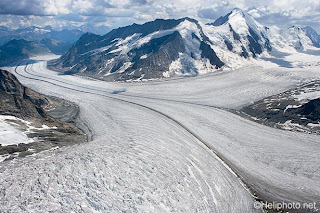


+China%27s+Tibet+Autonomous+Region.jpg)


+China%27s+Jilin+Province.bmp)
+China%27s+Shaanxi+Province.gif)

